Sierra Buttes Vista
25555 Highway 49 : Sierra City, CA 96125
Sierra County, California
Farm Description
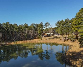
Sierra Buttes Vista is 466 acres of prime recreational land in Sierra County, CA. This scenic property is located along highway 49 near the mighty North Yuba River, between historic Downieville and Sierra City. Nestled in the Tahoe National Forest between Nevada City and Truckee, this versatile Sierra Nevada property is excellent hunting land with development potential. This mountain property is ready for your cabin, home or recreational retreat.
Land
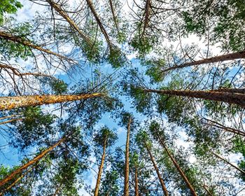
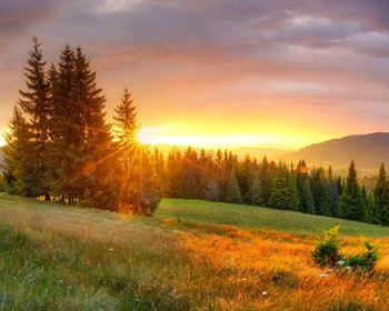
SELLER Financing Available AT 6. The property is 466.34-Acres and ranges from mild to moderately to steeply sloped terrain. It is forested with a rich variety of native trees, shrubs, grasses and flowers, including oaks, pines and other trees. Ladies Canyon Creek runs through the northwest part of the property and the North Yuba River is a short distance to the south. This scenic property borders public land and includes rich habitat for deer and other wildlife and supplies a wide range of opportunities for the outdoor enthusiast. The primary access point is an entrance on CA 49 with internal access roads through the terrain. The property includes ideal building areas for a home, cabin and/or recreational building and structures. Great southerly exposure provides an ideal location for solar powered infrastructure equipment / utilities.
Improvements
A comprehensive driveway and roadway development / engineering plans are complete and available.
Recreation
A full complement of outdoor activity opportunities are on the property and in the region including hunting, camping, hiking, wildlife viewing and more. Endless other activities are plentiful in the surrounding hills, mountains, lakes, rivers and streams of the Sierra Nevada. The Yuba River Scenic Byway is a 160-Mile-Long loop along some of Northern California's prettiest and most historic routes. See Gold Rush towns, two high country passes across the rugged Sierra Nevada, as well as the Truckee-Lake Tahoe region. This route takes in the Yuba-Bear and American River watersheds. Nearby rivers and streams supply excellent fly fishing and other river sports. Enjoy the fun and amenities of historic Sierra Gold Rush towns as you pass though Nevada City, North San Juan, Camptonville, Downieville - the County Seat, Sierra City, the Bassetts Station, Sierraville and Truckee. The entire route is rich with Sierra scenery thick green forests and historic homesteads, sparkling rivers and streams, scenic lakes and viewing vistas along the highway. There are many places to stop and eat and rest by the roadside for hours or overnight. The nearby Sierra Buttes is an 8,591-Foot-Elevation mountain summit, the third highest in the county. The Pacific Crest Trail crosses CA 49 just five miles east of the property. Kings Beach at Lake Tahoe is just 1.5-Hours southeast providing some of the finest and most desired recreational areas in the western U.S. Closer to the property, the historic communities of Downieville, Nevada City and the other mountain towns along CA 49 provide a variety of shops, restaurants, hotels, dining and more. See the Resource section for more information.
Region & Climate
It is a place of legend, nestled into lush canyons and surrounded by some of California's most rugged peaks. Nowhere else in the country, or perhaps the world, does such a place exist. To some, we are known for world-class mountain biking - drawing in participants from around the world to take part in events such as the Downieville Downhill. Others enjoy special events such as the Music at the Kentucky Mines, or the Yuba Theater's Banff Film Festival. Some know us for our cultural events, historic mine tours, and endless outdoor activities. The people of the area are embraced for their authentic mountain character, unpretentious attitude, and celebration of four seasons of adventure in the most beautiful spot of all the Sierra Nevada range.
History
The property is located a short distance from Downieville, the County Seat, at the confluence of the Downie and North Yuba River. For centuries, Sierra County area has been a special destination. From the days when some of the first Americans, the Washoe people, spent summers on the Sierra Valley Floor and the Miwoks danced in the hills of the western slope To the mining era that established the towns. They quickly filled with miners who ventured here in the 1850S set out to enrich themselves with gold. They installed wooden boardwalks, quaint narrow streets, and buildings and bridges that follow the river's edge, all still accessible to visitors today. With the rushing clear waters of the Yuba and Downie Rivers, the expanse of the Eastern Sierra Valley, the alpine lakes filled with trout, and all crowned by the Sierra Buttes, the county is considered one of the most iconic, yet hidden, mountain destinations in the United States. Throughout its rich history, the county and the people that call it home have embraced a frontier spirit, a warm, friendly demeanor and an insatiable thirst for all the adventure these mountains provide. See the Resource section for more information.
Location
The property is located under 9-miles east of Downieville on CA 49, AKA The Golden Chain Highway, running along the North Yuba River. The bustling town of Nevada City is a bit over an hour's drive to the west with Grass Valley a few mins further along CA 49. Lake Tahoe is just 1.5-Hours to the southeast. See the Recreation, Region & Climate Description, and History sections for more information.
Directions to Farm
From Downieville: Travel east on CA-49 for approximately 8.8-miles. Turn left at the shared driveway entrance on your left. Provide up the driveway for 50-yards and the property drive access is to your right.
From Truckee: Travel north on CA-89 S for approximately 24-miles. At CA-49, turn left and travel south for approximately 26.5-miles. Turn right at the shared driveway entrance on your right. Provide up the driveway for 50-yards and the property drive access is to your right.
More Farm Details
More Farms from Hayden Outdoors
 New461.6 AC : AUCTION
 472.7 AC : $895K
 114.7 AC : $2.5M
 251.5 AC : $950K
 3,252 AC : $4M
 263.5 AC : $2.59M
 950.8 AC : $5.5M
 80 AC : $1.6M
 1,222 AC : $10M
 505 AC : $4.39M
 8,989 AC : $32.3M
 1,484 AC : $3.7M


