80 Acre Near Wells, Just Off Hwy 93
Sec 9 Lot 3 Hwy 93 : Wells, NV 89835
Elko County, Nevada
Farm Description
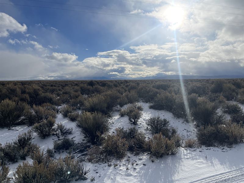
Escape to your very own 80-acre haven, just 18 miles south of Wells via the scenic US Highway 93. Access is a breeze with a road leading directly to the property, situated just a mile from the highway. This expansive parcel boasts a flat topography, providing an ideal canvas for your vision.
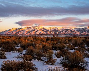
Enjoy breathtaking mountain views that envelop the property, creating a picturesque backdrop for your dream retreat. Power lines are within a mile of the property. Well drilling and farming is seamless in this flat terrain.
Nature enthusiasts will delight in the proximity to the East Humboldt Wilderness, offering nearby hiking adventures. The neighborhood is connected by well-maintained dirt roads, adding to the ease of exploration.
Convenience meets tranquility as this oasis is just over an hour from Elko, providing a perfect balance between seclusion and accessibility. Need groceries or gas? Wells is a mere 20 minutes away, making daily essentials within easy reach.
Don't miss the chance to own this 80-acre slice of paradise-where flat, workable land meets mountain views, and convenience meets the great outdoors. Act now and turn your dream of expansive living into a reality.
Flexible Financing Options:
No-Credit Check seller financing options for you as low as $576/Month.
1- $11,399 down - 60 mo at $576/Mo - total: $45,959
2- $3,800 down - 72 mo at $712/Mo - total: $55,064
3- $769 down - 83 mo at $769/Mo - total: $64,596
Or Cash Today discounted price of: $37,997
Gps Coordinates accurate within a few yards. (Official survey often required before building)
APN: 00831I003 Coordinates - 40 Acres
Legal Description: S2n2ne4 SEC 9 TWP 34N RGE 62E Mdb&M
Center: 40.847844, -114.974208
Ne: 40.8487187, -114.9696773
Nw: 40.8487187, -114.9790198
Se: 40.8469034, -114.9696773
Sw: 40.8469034, -114.9790198
Apn: 00831I002 Coordinates - 20 Acres
Legal Description: N2nw4ne4 SEC 9 TWP 34N RGE 62E Mdb&M
Center: 40.849384, -114.976671
Ne: 40.8504801, -114.9741646
Nw: 40.8504801, -114.9790207
Se: 40.8487174, -114.9741646
Sw: 40.8487174, -114.9790207
Apn: 00831I010 Coordinates - 20 Acres
Legal Description: N2se4nw4 SEC 9 TWP 34N RGE 62E Mdb&M
Center: 40.846011, -114.981525
Ne: 40.8469335, -114.9790387
Nw: 40.8469335, -114.9838470
Se: 40.8451184, -114.9790387
Sw: 40.8451184, -114.9838470
Farm Maps & Attachments
Directions to Farm
Copy and paste one of these coordinate pairs into Google Maps for driving directions:
Ne: 40.8487187, -114.9696773
Nw: 40.8487187, -114.9790198
Se: 40.8469034, -114.9696773
Sw: 40.8469034, -114.9790198
