Shaw Road Forest
Fort Gaines, GA 39851
Clay County, Georgia
Farm Description
Location:
Shaw Road Forest is located within the upper coastal plain region of Southwest Georgia, which is noted for its rolling terrain. This area is known for its strong mix of agriculture and timberland. The tract is surrounded on all sides by other timbered properties. The adjoining tracts are both owned by the forest industry and individuals.
The town of Fort Gaines, Georgia, is just five miles away. Fort Gaines provides fuel, groceries, and dining options. It also has a small medical center. Lake Eufaula and the Chattahoochee River are also only minutes away.
The tract has frontage on three separate public roads, giving it exceptional access, whether for timber or recreational activities. It has a frontage on GA Hwy 266 and can be reached from US Hwy 431 in Abbeville, Alabama, in 20 to 25 minutes, and from US Hwy 27 in Cuthbert, Georgia, in about 15 minutes.
The city of Eufaula is about 30 minutes away. Both the cities of Dothan, Alabama, and Albany, Georgia, are an approximate hour away. These larger towns offer multiple hotels, dining, grocery options, and hospitals. Albany and Dothan each have a Regional Airport. You can drive to the Columba airport in two hours or to the Atlanta airport in three hours.
Access:
With extensive public road frontage, Shaw Road Forest has approximately 7,900 feet along Pecan Road, a dirt county road, 3,200 feet along Bethal Road, a paved county road, and 4,400 feet along GA Hwy 266. These county roads provide primary access to the tract.
This property has functioned as a timber-producing property; thus, it has multiple access points and an excellent system of interior logging roads, trails, and paths. Many are suitable for 2×4 vehicles with good ground clearance but may require 4×4 during wet periods. Most trails and paths are traversable by vehicle, but some would require an ATV or Utv. Power is directly accessible on the southwest side of the tract along GA Hwy 266.
Site Description:
Given its make-up and location, this tract offers a very real opportunity to manage trophy whitetail deer and take advantage of a dynamic timber market.
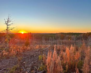
Nearly 90% of the acreage is on upland sites with well-drained soils rated well for timber production. Tract elevations range from 180 feet above sea level at the lowest point along Waukeefriskee Creek to close to 390 feet at the highest points. While the pine plantations are young, the property still holds some very impressive views.
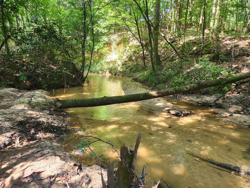
The tract had multiple established food plots of various shapes and sizes scattered throughout. These will provide forage, and the pine plantations provide cover. To add to the tract's diversity and attractiveness to wildlife, Waukeefriskee Creek provides a 1.6-Mile stretch of endless water supply and hardwood timber.
Southwest Georgia is known for its quality whitetail deer hunting. Having a tract this size will allow you to manage the herd for maximum potential. There are also healthy populations of turkey and hog in this area. The tract also has the size needed for multiple other recreational activities, such as horseback riding, ATV riding, bird watching, etc., where you can spend the whole day and never leave your property.
Lake Eufaula and the Chattahoochee River are just a few minutes away. Lake Eufaula is a 45,000 + acre reservoir that is renowned for its largemouth bass and crappy fishing. Many professional bass fishing associations hold tournaments there due to its high-quality fish. The current Georgia state record blue catfish also came from these waters. The lake's dam is only about 5 miles from the tract, allowing one to enjoy the Chattahoochee River on the lower side for kayaking or fishing real current.
Timber:
A stand-type map is included in this report. The tract has approximately 342 acres of loblolly plantation that is three years old and 559 acres that is seven years old. Both age classes appear to be well-stocked and growing well. Given that this part of Georgia has a very vibrant timber market, this tract holds incredible potential for timber income and management for the future.
Typical loblolly plantation management in this region follows this basic template. The first thinning occurs at or near age 15. While this is indeed an income-producing event, the purpose of this thinning is primarily to keep the timber healthy and developing well. It also helps the plantation transition from low-value products (pulpwood) into higher value (chip-n-saw and sawtimber). Depending on how well it responds to the first thin, there are times when a second thinning may be recommended at or near age 21 for the same purposes. This second thin also aids in transitioning into large sawtimber, veneer, and poles (should those markets exist in the area). Plantations usually reach their fullest financial maturity between the ages of 26 and 32, at which point they can be sold to reap the best return. During the life cycle of the plantation, other silvicultural treatments, if appropriately timed, can be considered to enhance growth or control competition. Examples are herbaceous treatment, woody release, fertilization, prescribed burning, etc. After the first thinning of plantations occurs, conducting a prescribed burn every two to three years helps suppress competing tree species but also greatly enhances wildlife value.
While Georgia Best Management Practices do allow a small extent of harvesting within the hardwood bottoms, we typically urge leaving these intact as they provide a protective buffer along streams to help keep water temperatures down and filtration from sediment. These also function as wildlife travel coordinators.

