Trammel Hideaway
Sylacauga, AL 35150
Talladega County, Alabama
Farm Description
Location:
Trammel Hideaway is located in the rolling hills of the upper Piedmont region of mid-east Alabama, close to the lower reaches of Appalachia. Ridges and valleys characterize the area. Located within the Talladega National Forest, this tract is adjoined by timberland on all sides. There is one owner who lives on the property to the south.
Lay Lake (on the Coosa River) and Lake Martin (on the Tallapoosa River) are less than thirty miles from the tract and offer boating, fishing, and swimming opportunities. For hikers, the Pinhoti Trail has an access point within the Talladega National Forest just minutes from the property. The Pinhoti Trail goes through the Southern Appalachian Mountains and is 335 miles in length through both Alabama and Georgia.
Sylacauga, Alabama, is approximately fifteen minutes to the northwest. It provides grocery, dining, hotel options,and a major medical facility.
The tract is just about twenty miles off of AL Hwy 48. US Hwy 280 is about five miles away, accessible just south of Sylacauga. Interstate 20 is just about an hour north of the property. Also, Birmingham-Shuttlesworh International Airport is approximately an hour and a half drive from the property. The Atlanta International Airport is approximately two and a half hours away.
Access:
Trammel Hideaway has one access point provided by a private drive that exists through adjoining timbered properties. Past forestry operations have used this access.
Internal access is provided by a single woods road used for logging in the past. The road has not been in use since the last harvest, but the roadbed exists and is currently suitable for 4×4, Atv, or Utv. The tract has direct access to power.
Site Description:
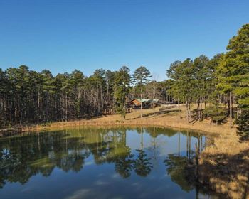
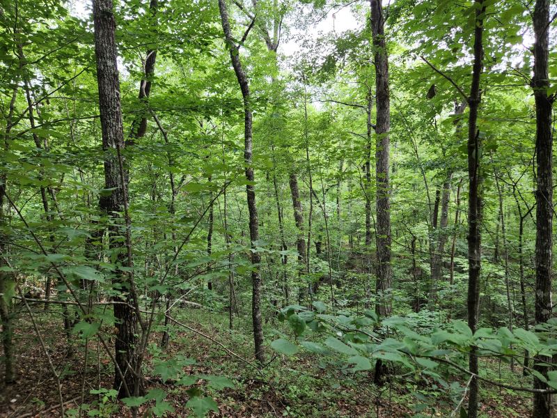
Trammel Hideaway is an ideal tract for someone seeking a secluded space for a cabin or home. The tract also offers timber and recreational potential. The tract has rolling terrain and some steep slopes.
Elevations run from about 700 feet along the creek's banks running across the northwest corner to an estimated 840 feet at the highest point in the southeast quadrant of the tract. There are an estimated 29 acres of well-drained, operable land with soils productive for timber.
A creek running across the northwest corner of the property provides access to water. The tract is completely timbered at present but has great aesthetic potential.
This area of the state provides good deer hunting opportunities. While on the tract, we have noticed plenty of evidence of their presence. Turkey, rabbit, and squirrel are also other possibilities. This tract is part of thousands of contiguous forested acres since it is part of the Talladega National Forest.
Wildlife possibilities abound. For hikers, the Pinhoti Trail has an access point within the Talladega National Forest just minutes from the property. The Pinhoti Trail goes through the Southern Appalachian Mountains, is 335 miles in length, and is located within the states of Alabama and Georgia. Both Lay Lake (on the Coosa River) and Lake Martin (on the Tallapoosa River) are less than thirty miles away. Both offer opportunities for boating, fishing, swimming, etc.
Timber:
The 29 acres of loblolly plantation were inventoried in September of 2019 in preparation for a potential timber sale. However, this timber was not sold and remains intact. The hardwood areas were not inventoried nor included in any harvest plans. It is reasonable to believe that volume has increased over the five years since the inventory was completed.
From purely a recreational or aesthetic position, this plantation could be thinned soon. Thinning would leave timber intact for beauty and future production but open up the tract so that the sun can begin to reach the forest floor to enhance wildlife browse.
For strictly timber production purposes, timber of this type makes its best production if thinned at or near the age of 15. This timber has not been thinned to date and is now 26 years old. Clear-cutting and replacing it with a new loblolly plantation may be advisable if decision drivers are directly tied to production and financial return.
Replanting with longleaf pine is also an option if replanting the long-term goals are more wildlife driven. The soils here are conducive to longleaf.
Whether longleaf or loblolly pine, if replanting is chosen, the process usually follows these steps. First, a chemical application is applied in the summer months to control competing woody and vegetative competition. Second, a burn is usually conducted in the fall following the chemical treatment to both aid in controlling competition and to “clean up” the site to some extent to aid planting. Third, planting occurs in the winter months while the seedlings are dormant. Total planting cost can run between and per acre, depending on the options and genetics chosen.
Once planted, typical loblolly plantation management in the areas roughly follows this timeline: it should be ready for a first thinning around age 14 or 15. Depending on growth and market conditions, a second thinning could occur around age 21. This region normally reaches financial maturity between the ages of 25 and 34. Each thinning and cutting produces income for the owner. Longleaf would be expected to follow a similar pattern, yet 6 to 10 years behind loblolly.
A second management area is an approximate 11 acres of hardwood dominated sloped and bottomland areas. Portions of these could be harvested and the value captured by a specialized crew if desired, however these also exist along the creeks where some timber must be left to protect water quality. These areas add wildlife value as there are hard mast-producing trees (oaks producing acorns), and they also act as wildlife travel corridors.


