Come On, 5 Acres Over Here
San Luis, CO 81152
Costilla County, Colorado
Farm Description
The urban lifestyle brings with it a story that seems to be written for you, with a script that oftentimes determines the course of your wellbeing and finances. That script is NOT a forgone conclusion, and owning this parcel can show you what can be accessible with click.
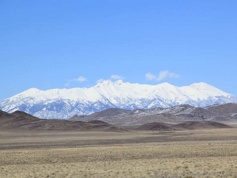
Nestled in the heart of beautiful Costilla County, this 5 acre parcel is tucked back from Co-142. Accessed by well-maintained dirt roads, you are mere minutes from your own patch of solitude. Beautiful views of Blanca Peak to the northeast, the Sangre de Cristo Mountains to the east, or look west to view Flat Top Mountain and Piñon Hills. Set off and fish the famous Rio Grande Cutthroat Trout in the Rio Grande or Culebra Creek (to name a few of the numerous fishing spots). Head north to go hiking in Brownie Hills, or book a private hike in the Sangre de Cristo Mountains. For a piece of history, visit Sangre de Cristo National Heritage Area in San Luis, CO (settled 1851), the oldest settlement in Colorado.
However your story reads, it begins with the deed of this parcel signed over to you.
GPS Coordinates (center): 37.169974, -105.673089
Gps Coordinates for all 4 corners:
NW Corner: 37.170903, -105.673692
Ne Corner: 37.170906, -105.672552
Sw Corner: 37.169038, -105.673674
Se Corner: 37.169044, -105.672542
Camping: Allowed with a permit
RV and Mobile Homes: Temporary RV Occupancy Permits are valid for 90 Days and a new application must be filed before the expiration date of the permit. Temporary RV Occupancy Shall NOT Exceed 18 Months. RV's must be inspected by the Planning and Zoning office to ensure all plumbing and electrical is in working order prior to application approval.
Assessed Value: $1,339.00
Property Taxes: $76.60
$250 Nonrefundable Document Fee W/ Down payment.
Farm Maps
Directions to Farm
From San Acacio, Co:
1. Head west on CO-142, 3.5 mi
2. Turn left onto Rd-10, 2.0 mi
3. Turn right onto Rd-M, 1.5 mi
4. Continue onto Nance Blvd, 0.2 mi
5. Turn right onto Calvin Rd, 0.5 mi
6. Turn left onto Leslie Rd, 2.1 mi
7. Turn right onto Edward Rd, 0.3 mi
8. Turn left onto Ana Ave
9. Take first right onto Ben Rd.
Property will be on your right.
