The Ranch at Lost Creek
1721 Aeneas Valley Rd 1813 Aeneas Valley Rd : Tonasket, WA 98855
Okanogan County, Washington
Farm Description
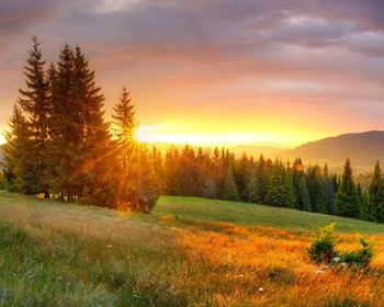
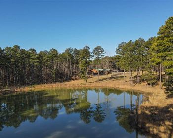
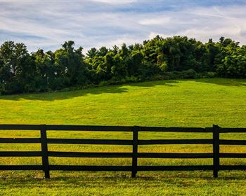
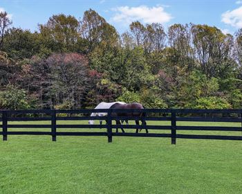
The Ranch at Lost Creek consists of 3 parcels totaling 759 acres is tucked away at the end of the well known Aeneas Valley within the northeast mountains of Washington State. The ranch is surrounded by 1000'S of acres of untouched public land allowing your adventures to extend far beyond the ranch's borders. 3 pristine year round creeks converge on the ranch forming the West Fork of the Sanpoil River on the ranch.
Recreation
Okanogan County, Washington has many recreational activities, including Hiking 3,000 miles of hiking trails in national forests
Winter sports The largest Nordic skiing system in the country, plus cross-country skiing, snowmobiling, and ice skating
Outdoor activities Fishing, boating, hunting, horseback riding, mountain climbing, hot-air ballooning, and off-road vehicle fun
Wildlife viewing Birdwatching and viewing other wildlife in the wide-open spaces
Scenic drives Scenic byways for family adventures
Farm tours Learn about locally grown produce
Wineries, breweries, cideries, and coffee roasters Sample local beverages
Day spas Relax in a luxurious day spa
Casinos Play games and enjoy food at casinos operated by the Colville Confederated Tribes
Region & Climate
Climate and Average Weather Year Round in Okanogan Washington, United States. In Okanogan, the summers are hot, dry, and mostly clear and the winters are freezing, snowy, and mostly cloudy. Over the course of the year, the temperature typically varies from 22 F to 91 F and is rarely below 8 F or above 100 F
History
Okanogan County, Washington has a rich history that includes the following events Early use by Native Americans
The Southern Okanogan Tribe, also known as the Sinkaietk or Uknaqinx, used the area for thousands of years as a fishing and camping ground.
Exploration by non-Indians
The Okanogan River was known to fur traders and other early non-Indian explorers in the early 1800S.
Settled by Europeans
Okanogan County was one of the last areas in Washington to be settled by Europeans due to its remoteness.
Prospectors' route
The area was an early route for prospectors traveling to British Columbia and other communities.
County seat
The county seat was moved from Ruby City to Salmon City in 1888, and then to Conconully. In 1914, Okanogan won the election to become the county seat, defeating Omak.
Incorporation of Okanogan
The town of Okanogan was incorporated on October 29, 1907.
Grand Coulee Dam
Construction of Grand Coulee Dam, the largest producer of electricity in the U.S., began in 1933 and was completed in 1942.
Murals discovered
In 2022, murals painted by Wenatchee artist W.J. McConnon were discovered during renovations to a commercial building in Okanogan.
Today, Okanogan County is a highland desert with mild winters and arid summers. It's a popular destination for outdoor activities like fishing, boating, hiking, hunting, and skiing.
Location
Okanogan County is located in north-central Washington state, along the Canadian border Location
Okanogan County is bordered by British Columbia, Canada to the north, the Columbia River to the south, the Cascade Mountains to the west, and Ferry County to the east.
Size
Okanogan County is the largest county in Washington state, covering nearly 5,300 square miles.
Geography
Okanogan County is a highland desert with arid summers and mild winters. The county is dominated by agricultural land, public and private forests, and shrubsteppe.
Outdoor activities
Okanogan County offers many outdoor activities, including fishing, boating, hiking, hunting, golf, skiing, snowmobiling, and off-road vehicle fun.
Notable features
Okanogan County is home to the Methow Valley, which includes Winthrop and Sun Mountain Lodge. The county also features the North Cascades Highway, which ventures east after crossing Washington Pass, the state's second-highest pass.
Name
The name Okanogan comes from the Indian word okanagen, which means rendezvous.
More Farm Details
More Farms from Hayden Outdoors
 New461.6 AC : AUCTION
 486 AC : AUCTION
 251.5 AC : $950K
 472.7 AC : $895K
 114.7 AC : $2.5M
 3,252 AC : $4M
 80 AC : $1.6M
 950.8 AC : $5.5M
 263.5 AC : $2.59M
 1,222 AC : $10M
 505 AC : $4.39M
 480.3 AC : $2.3M


